southgate masterplan
competition
The Budapest South Gate International Masterplan Design competition
organized by the KKBK Centre of Key Government Investments Nonprofit, called
for a new urban development in Budapest in the „Danube zone”. The landscape
architecture design proposal constituted of 3 distinctive areas: 1. Performative
wetland – as a park and flood mitigation site, 2. Landwork area – an open park conceptualized
as a park for the city, and 3. Waterfront urban area – as a public space for
the newly built area.
architectural studio Eisenman Architects, Elisa Cattaneo, Degli Esposti Architects
co-designer for the Landscape Design with Landscape Architect Elisa Cattaneo
transport system design: “Systematica”
selected for the second phase of the competition
architectural studio Eisenman Architects, Elisa Cattaneo, Degli Esposti Architects
co-designer for the Landscape Design with Landscape Architect Elisa Cattaneo
transport system design: “Systematica”
selected for the second phase of the competition

landscape strategy
The area falls under the so-called „Danube zone” and „Transitional zone” determined in urban development strategies, and it has direct connections with the Danube as well as the Soroksári Danube Branch, while the larger surroundings around the area are typically brown field areas.
The purpose of the design competition was to implement a livable urban development, for a 100 hectare area, which is able to generate adequate housing for 12.000 university commoners and catalyze urban development in this region and due to new functions, sports facilities, significant green areas and high quality public spaces, represent a healthy and attractive neighborhood.
The Landscape strategy aims at creating an urban park, which strengthens the relationship of the city with the water, and adds valuable ecological relations through the green areas designed, that are connected to a system of paths and green areas in the city.
1 athletics Arena
2 national Sports Museum
3 sporting Retail
4 running Trails
5 athletics centre and warm-up fields
6 whitewater Kayak-Canoe Slalom pool
6A finish pool
6B race corse
6C training course
6D audience seatin (1000 seats expandable to 7000 seats)
6E clubhouse
6F temporary Facility Zone
6G car parkıng and bıcycle parkıng rack
7 indoor Athletics Hall
7A bus and car parkıng and bıcycle parkıng rack
8 extreme Outdoor Sports Center
8a main building
8b bmx race track
8c audience seating (200 seats expandable to 4800 seats)
8d car parkıng and bıcycle parkıng rack
9 city park
10 flood lakes
11 water distribution on site
12 buffer zone
landscape from historical maps
Autor Marsili, Luigi Ferdinando, 1658-1730
Mappa Comitatus Pilisiensis Methodo Astronomico-Geometrica concinnata
Autor Mikoviny, Samuel, 1700-1750
Autor Mikoviny, Samuel, 1700-1750


landwork
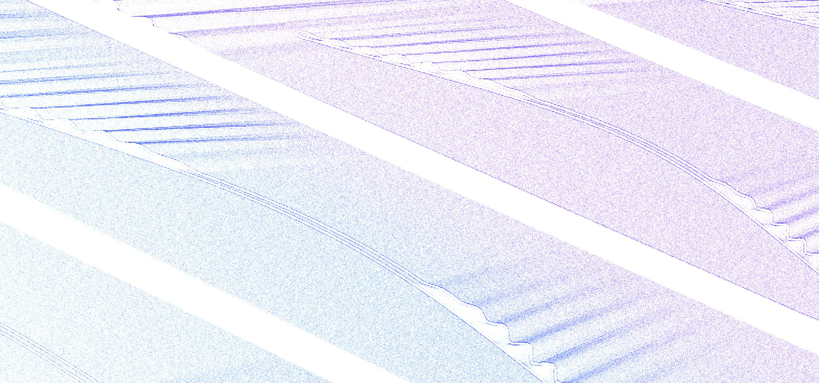
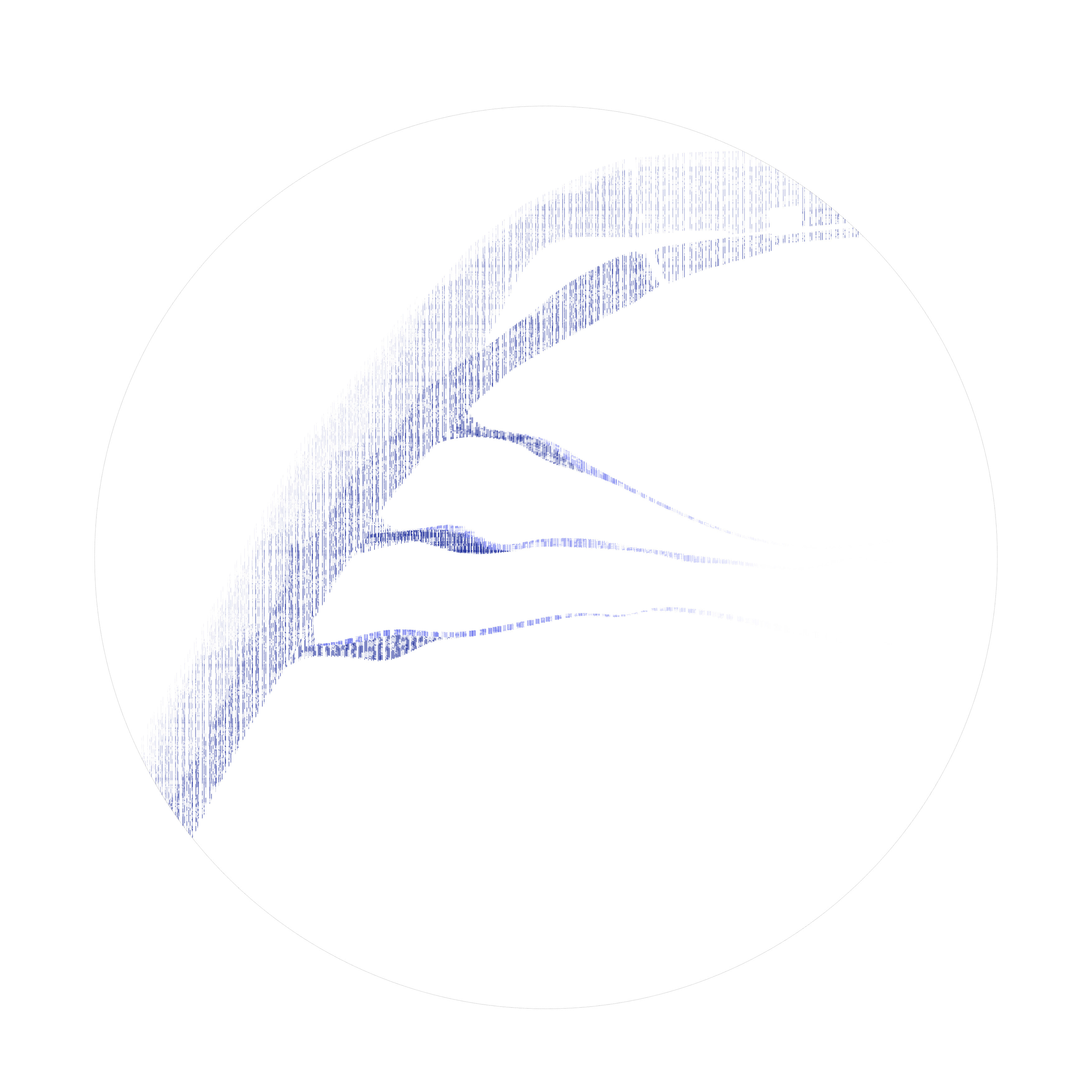
The main element of the Project Area I is the park which is conceptualized as a Land work. Taking from the historical landscape - the corrugated landscape is manipulated in different scales and heights while using the same system; the corrugation is largest on the western part and slowly reduces in height and width, which creates different experiences along the site. The park is thought of as not only a place for the student community but as a park for the whole city. The central area of the park is mostly flat so that it accommodates a large number of people, hosting also large city events.


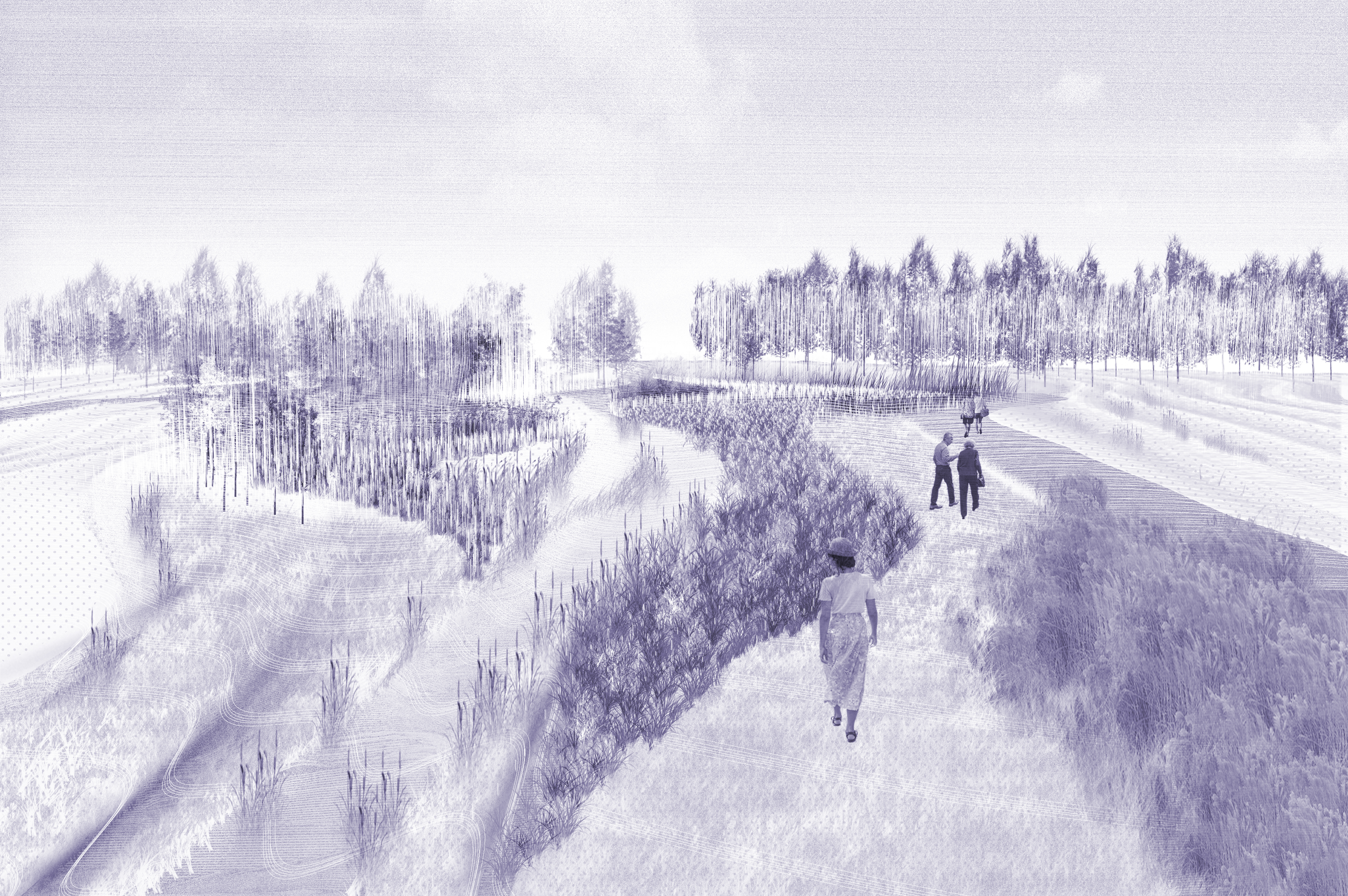
performative wetland
The site currently is a floodplain area, also containing an inert landfill site. The design of the Park in the project area II seeks to emerge from natural systems. The water is brought to the site not only to become the main urban element, but it enters the site in such a way that it works as a flood control site, at the same time cleaning the contaminated area.
The area adapts itself to the different levels of the water, generating an always-changing landscape thanks to the floodplain strategy. While the defined areas give extra volume for the water to reduce flooding risk, they create the conditions for a variety of new recreational scenarios.
The water becomes a part of the daily movement and in this way the site strengthens the connection between city and water, and seeks to raise awareness on the role of water in the environment.

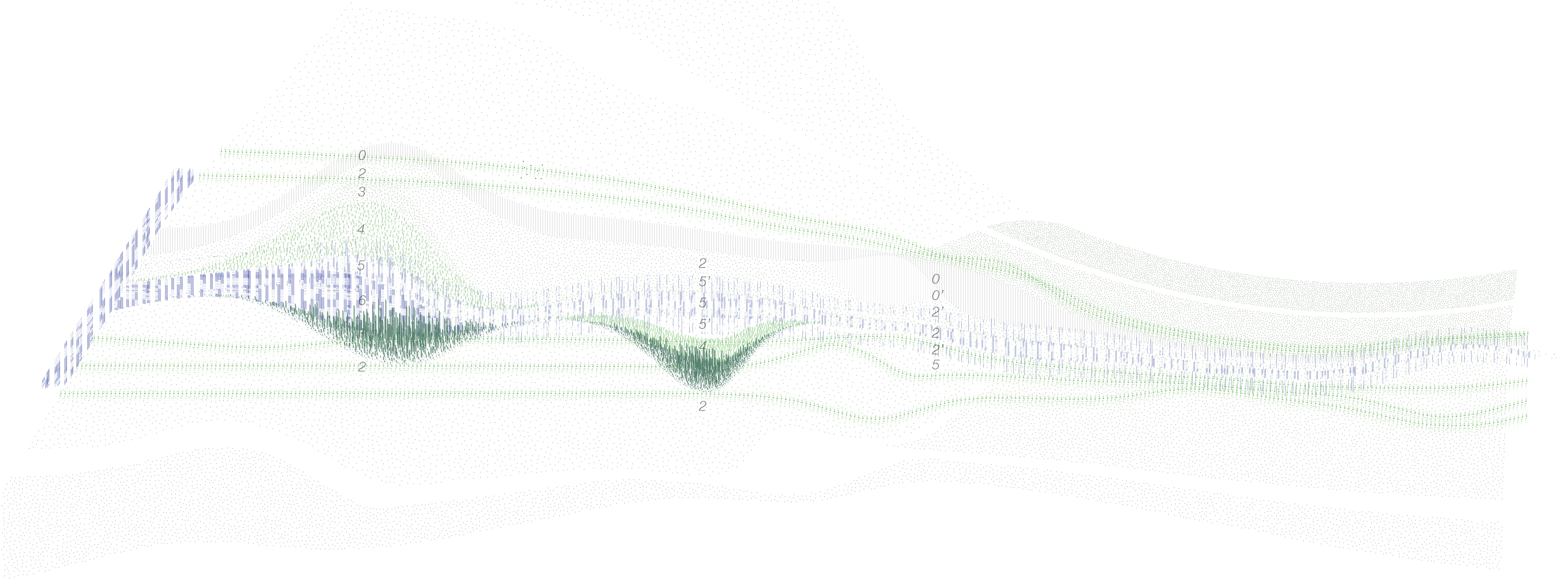
amount of water
0. path
0’. extention of the path to create a larger public use area
1. high vegetation - this layer is used to create a boundary for the water; the valley created forces the water to flow in the other side of the channel
2. grass
3. wetland low vegetation
4. wetland medium vegetation
5. water channel in case of more flood. This layer is also used to purify the soil through the presence of water and vegetation
6. deeper water/lake - the first ponds in


+39 327 633 6139 +383 44 135 472
erzadinarama@gmail.com
erzadinarama@gmail.com
Erzë
Dinarama unless otherwise specified

© 2