earthy indexes
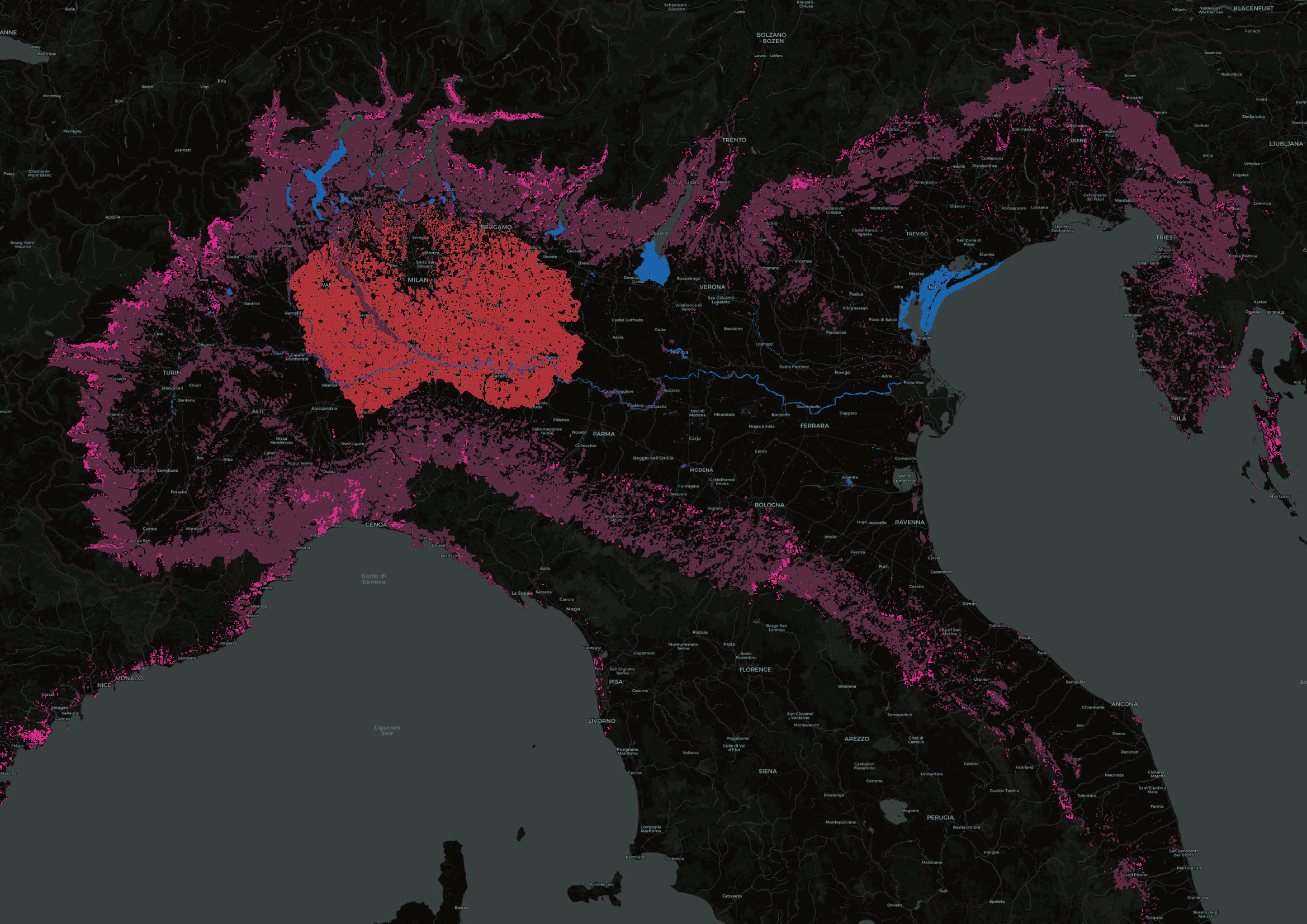
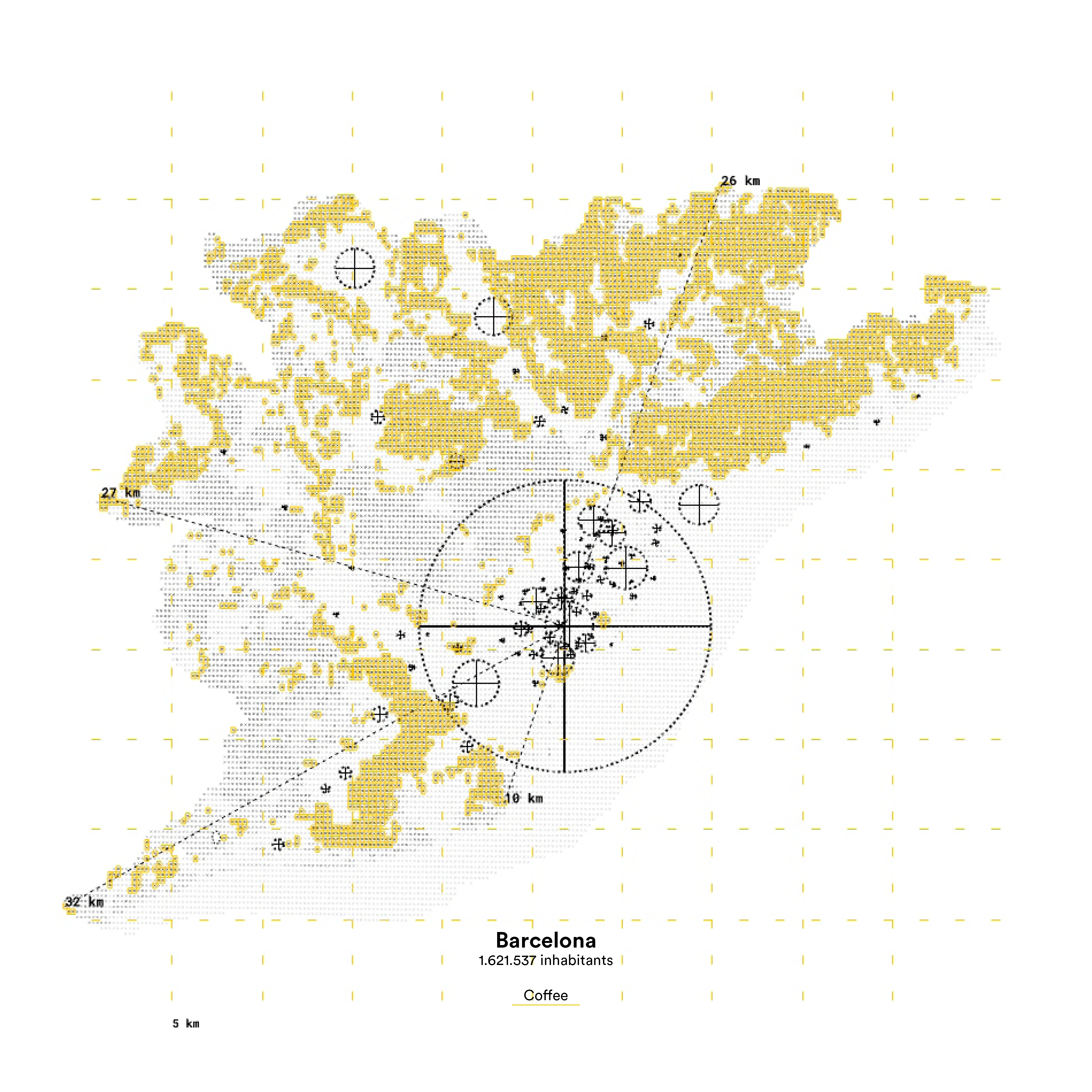
“Earthy Indexes” explored the ecological impact of cities from a spatial perspective, analyzing and visualizing the impact that cities have on the surrounding territory and beyond. The speculative exercise aimed at helping designers investigate what and where the “urban” is, recognizing the blurring of rural and urban phenomena. It also aimed at bringing designers closer to the abstract world of environmental indexes.
Participants were invited to create their own ecological index, according to their analysis, following different environmental narratives.
The workshop introduced students to geospatial data mining through Google Earth Engine in Grasshopper 3D. It aimed at providing students with a pipeline, to dynamically access and manipulate petabytes of online georeferenced data.
Workshop led by Erze Dinarama, and Iacopo Neri
The workshop was part of CAADRIA 2022 Conference - Post-Carbon, Sydney, Australia
International Conference for The Association for Computer-Aided Architectural Design Research in Asia
Drawings by: Tania Papasotiriou and Ilaena Napier
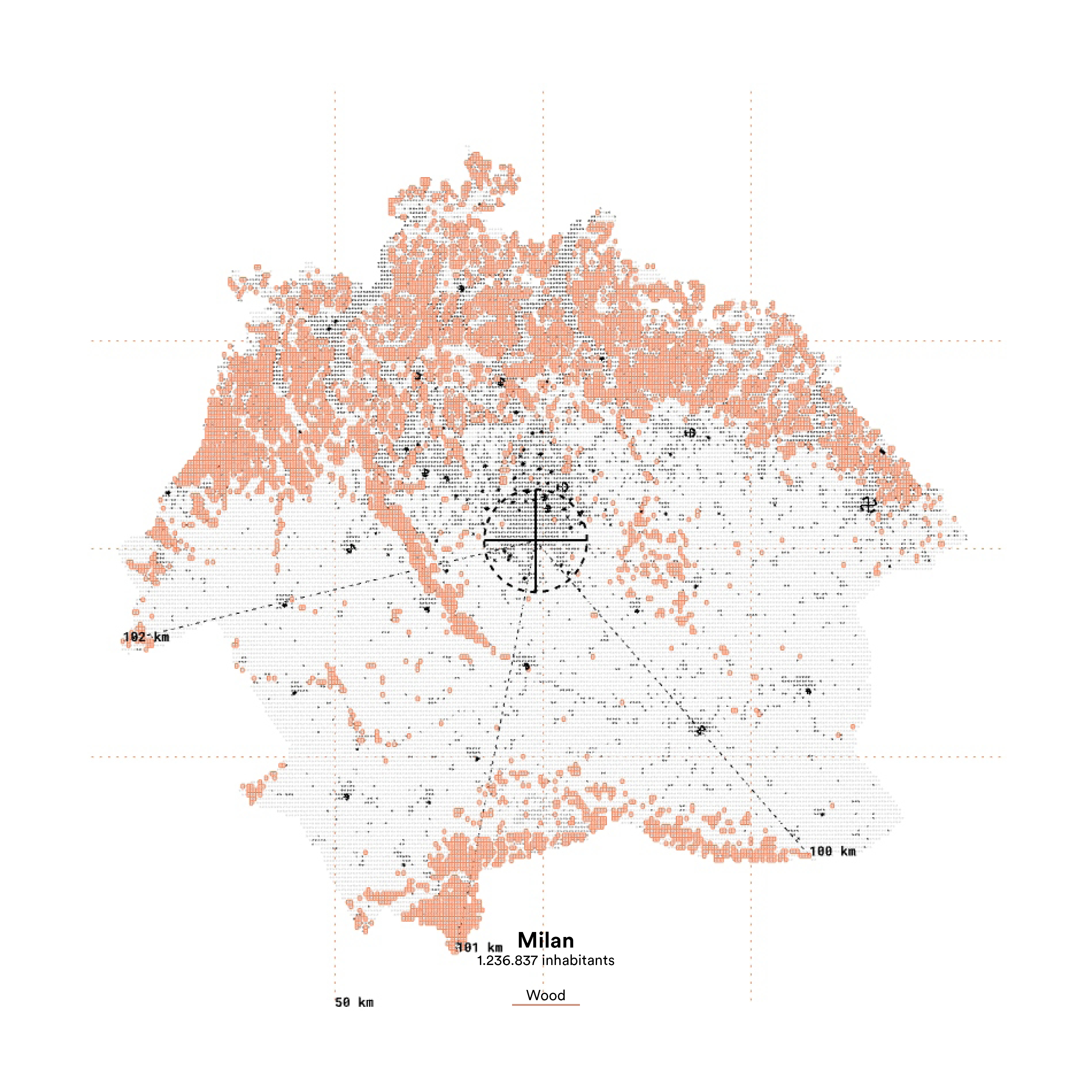
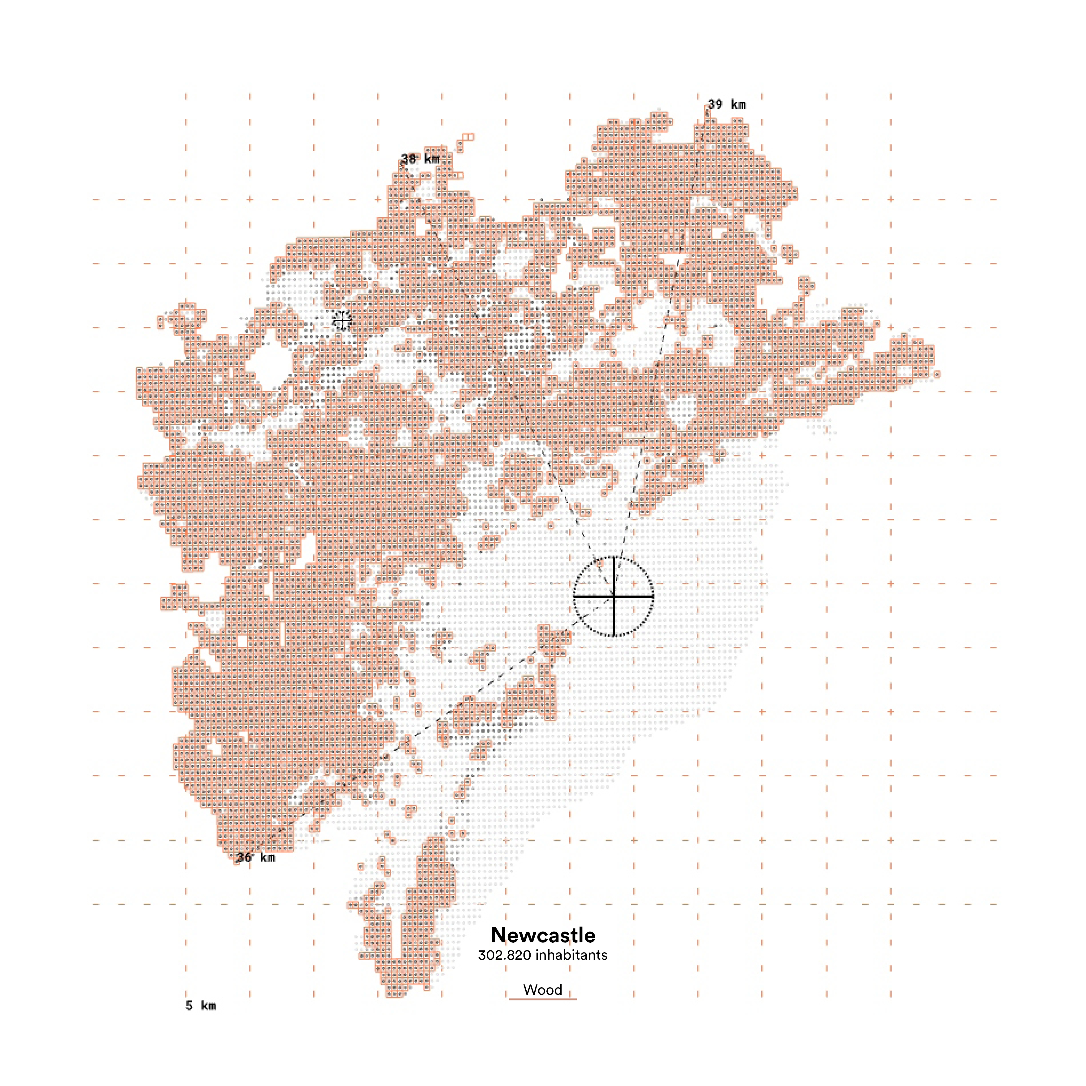
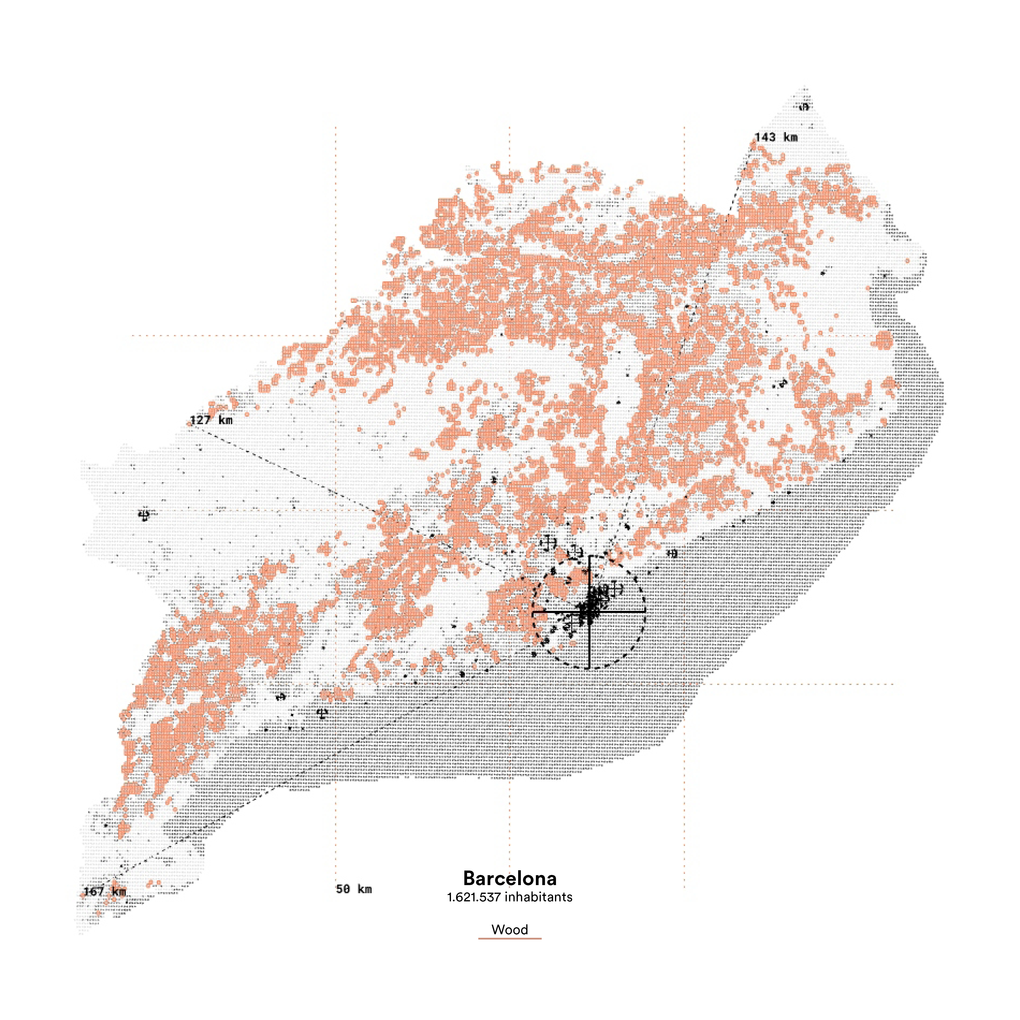
Land requirement to fulfill the demand for: Coffee, Beef, and Wood.
More info at https://caadria2022.org/workshops/


+39 327 633 6139 +383 44 135 472
erzadinarama@gmail.com
erzadinarama@gmail.com
Erzë
Dinarama unless otherwise specified

© 2