inbetween
disturbances
A twin town is added to the earthquake prone
town in Umbria, Italy - Norcia. The
second town becomes a refuge in case of an earthquake, and it functions in the
meanwhile as an agritourism place. It is built in such a way that it follows
the cycle of the earthquake, and the system is allowed to fail; able to
synchronize with the earthquake. The same procedure is repeated in the other earthquake
prone towns in the region: Cascia, Preci, Visso.
The concept of disturbances in ecology becomes the driver of the project.
The concept of disturbances in ecology becomes the driver of the project.
Polytechnic University of Milan
prof. Elisa Cristiana Cattaneo, prof. Simone Giostra
seismic towns
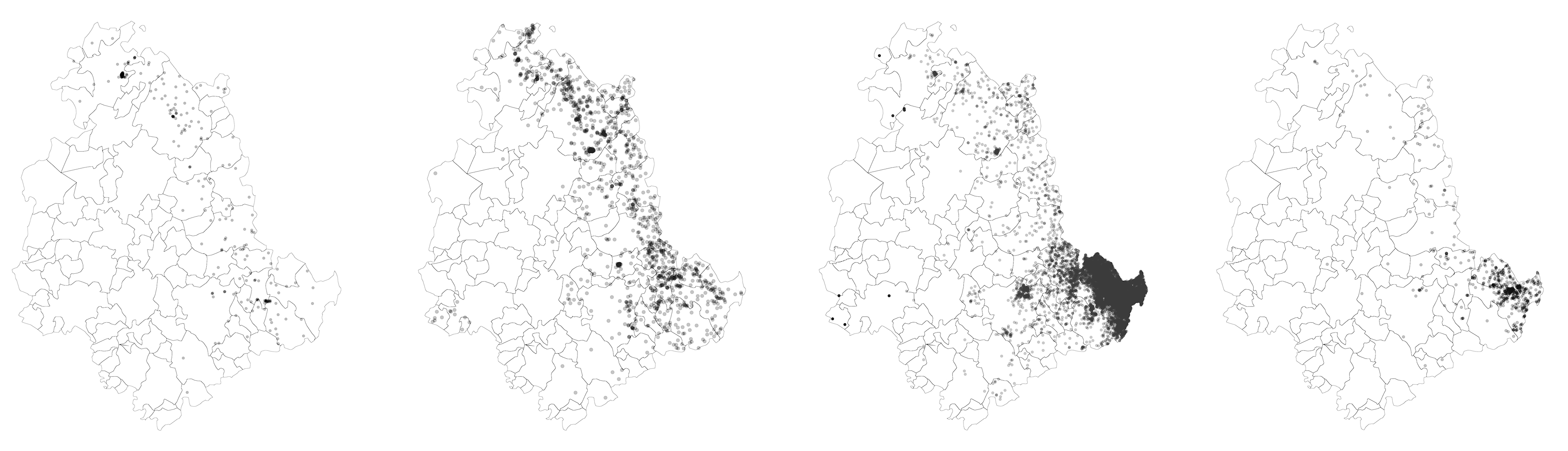
In the area around Norcia the time between two earthquakes varies, it can be 30 or 300 years. Although the magnitude of the earthquakes is not always high, the area around Norica is prone to earthquakes – the earthquake faults pass in the area. Norcia is relatively small – the city hasn’t grown in size greatly since it has been established. On the other hand the population in the municipalities around Norcia is declining. These small towns not only are in constant threat to earthquakes but are placed in a quite complex terrain as well.
seismic
events in Umbria December 2016-January 2018; although the magnitude is not
always very high, earthquakes are constant events in the region of Umbria
double towns
For these reasons, an out of city network is proposed; another settlement is created in vicinity to the existing one. This new network would keep the whole area running, even if parts of it fail. The double towns would create a system where places and events are in relation to one another, so that not only parts of it are allowed to fail and the system would still function, but the system depends on these “failures”.
Potentials of out of city context are explored in order to understand in what functions the network should rely on.
The same idea follows for the architecture scale. The most important concept in seismic design is ductility. Sometimes the problem with very ductile structures is that stiff parts of it get destroyed and the damage is very costly to fix. But, what if the building is designed in such way that some parts of it are meant to fail/decay anyway? The project explores the idea of a shorter lifecycle of a part of a building – non-supporting elements, and a longer one for the structure – supporting elements. In this way, the tectonic monument emerges which has the same task as the network on a regional scale. In this way disturbance is an integral part of the whole system.
mutualism
Mutualism in biology is the way two organisms of different species exist in a relationship in which each individual benefits from the activity of the other. New settlements are added in vicinity to the existing ones. The existing towns remain centers for cultural activities whereas the new settlements which function as an add on of the existing ones become centers for “out-of-town” activities: agriculture, farmer’s market, agritourism, hiker’s stop, etc. The project builds on the local economy, generating income throughout the year and it is based on the local agriculture. Besides providing food and energy for the existing town, the new settlements are the first point to seek refuge to after an earthquake. Not only can the people from the nearby town find shelter, but jobs as well. The small size of these towns in Umbria (Norcia, Cascia, Preci, etc.) as well as the distance between them, makes it feasible to have such a network, where in 15 minutes drive one finds himself in the “double” town, which is a less improbable scenario in bigger cities. The double town gives this region an opportunity to “catch up” with the earthquake.

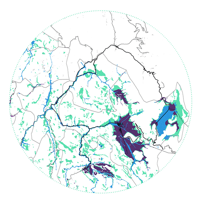 soil composition
typical soil pattern emerging in vicinity to the street
 landslides
 in vicinity to the street network and the typical soil pattern
 stability and instability of the found soil
pattern
in vicinity of the stable and unstable soil
stability and instability of the found soil
pattern
in vicinity of the stable and unstable soilstable/semistable/unstable
According to the data, there is a relationship between soil types, landslides, and what is considered by the National Institute of Geophysics and Volcanology as stable, semi-stable and unstable areas. All these patterns are found together and in vicinity to the street network.
The project site is placed exactly in such conditions; close to the street network – better connected to the existing towns as well as reachable in case of an earthquake, nearby the stable/unstable pattern – the unstable areas with particular soil types help make the landscape more fertile and can be used for agriculture.

disturbances map
landslides - unstable
debris flow - possible amplifications
alluvial deposit - stable
water runoff - the water lines coincide with the debris flow
landslides - unstable
debris flow - possible amplifications
alluvial deposit - stable
water runoff - the water lines coincide with the debris flow
disturbances
According to Richard Forman, in landscape ecology, disturbances can be healthy for the landscape if they don’t occur on a greater scale. If they occur on a smaller scale, the landscape is able to recuperate in a short period of time, whereas, if the forces of disturbance occur on a larger scale it can permanently alter the ecosystem. Therefore, the first operation is to map the areas where disturbances take place and stabilize only a part of them, so that the disturbances still take place but do not extend past the perimeter or at a larger scale. This is done through the technique of soil nailing, where the soil nails can mostly perform more than one function and then be used as a foundation for the added infrastructure.

soil nailing
Soil
nailing is a technique used to strengthen the ground, in the areas on the site,
previously mapped to be stabilized. Besides stabilizing the soil, the system is
used as the construction grid for the added infrastructure.
This
technique also coincides with seismic design – where foundations have to go
deeper.
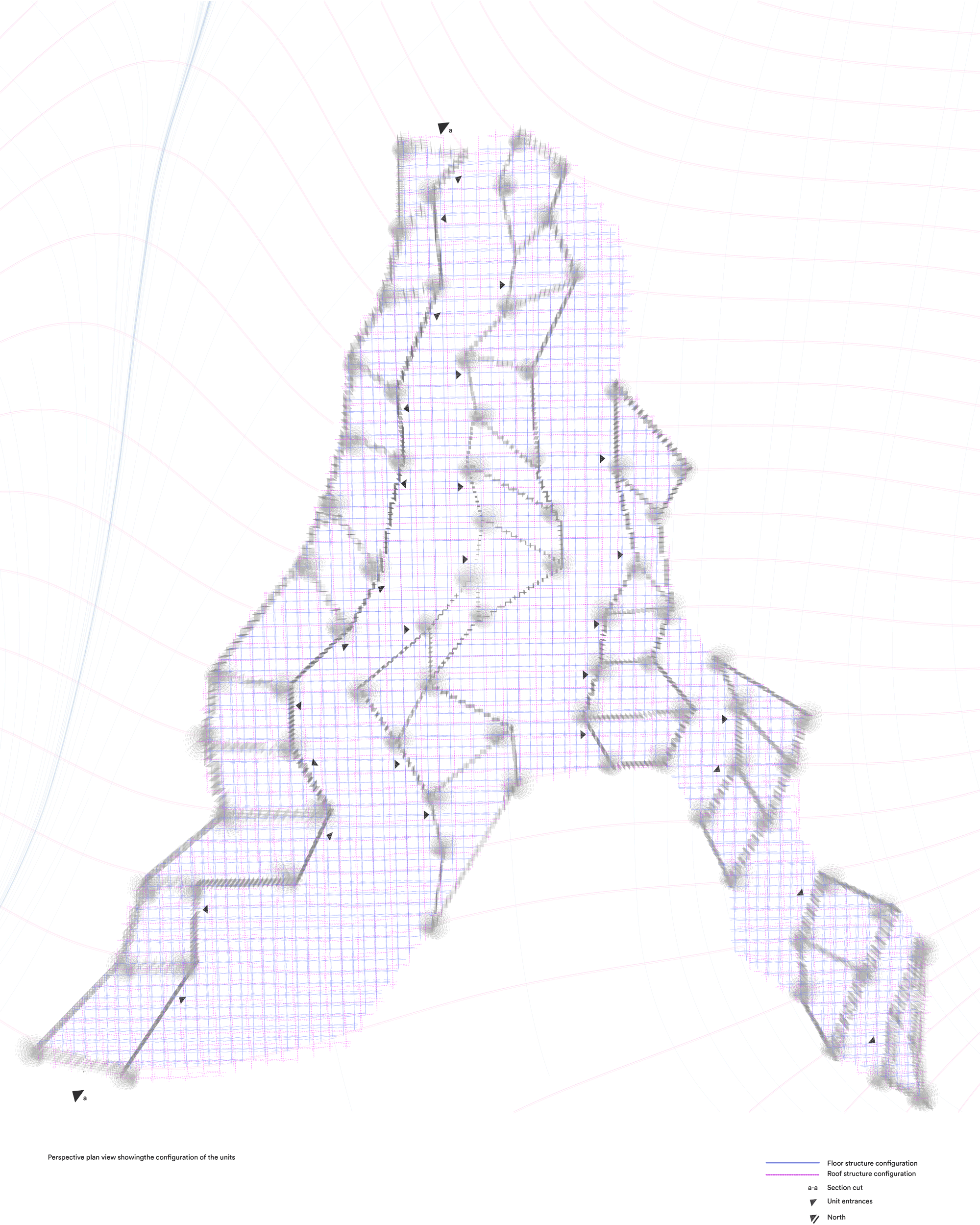
Where the
grid/network is denser - it is used for the residential housing units, whereas
where is it less dense - for other purposes: lower terrain - potential
geothermal borehole heat exchangers, higher terrain - potential windmills.
This independence from the energy grid is crucial in
case of the earthquake.
The process of stabilizing the soil serves not
only to create a more resilient settlement during the earthquake, but it also
keeps the streets operative in case of an earthquake by avoiding landslides.
Additionally, it maintains the soil fertility so that it can be used for
agriculture in times of crises.
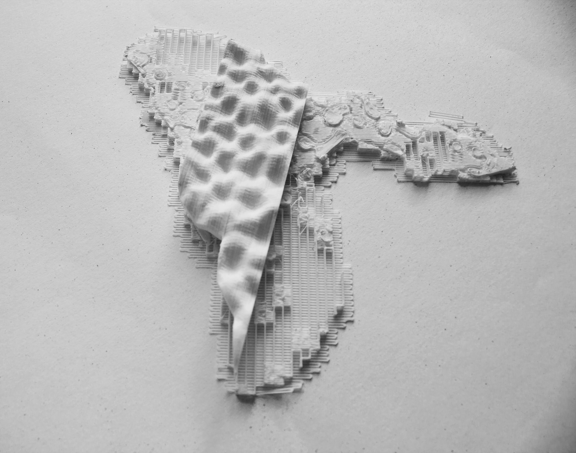
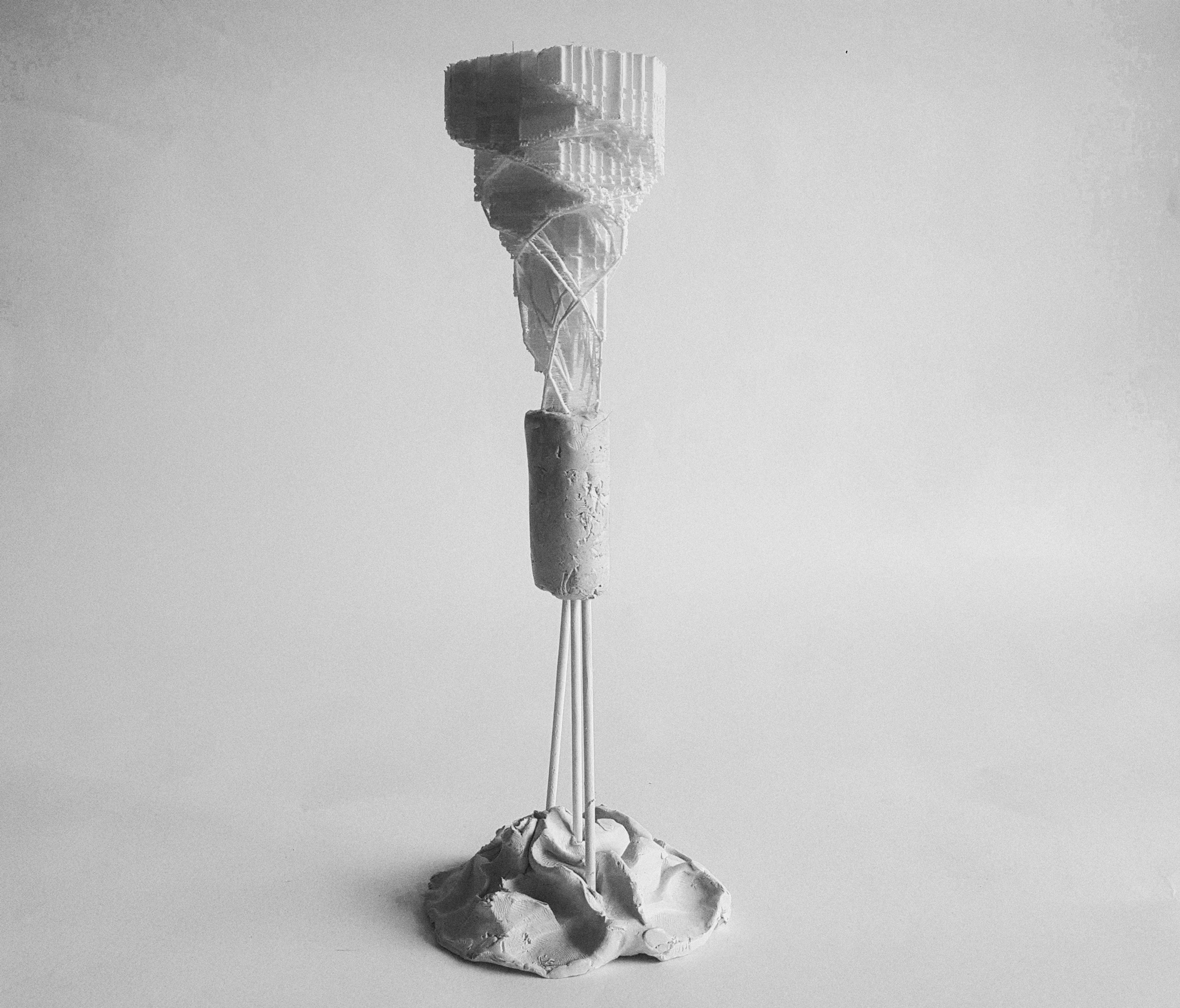
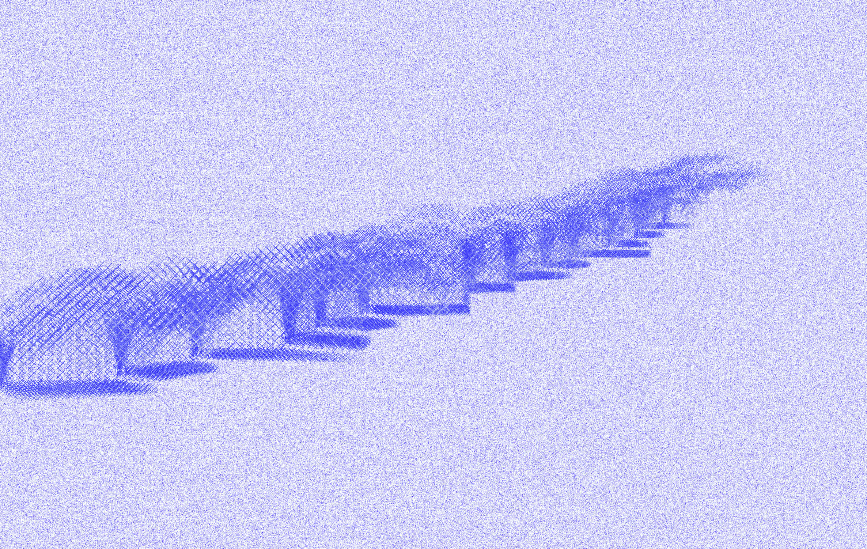
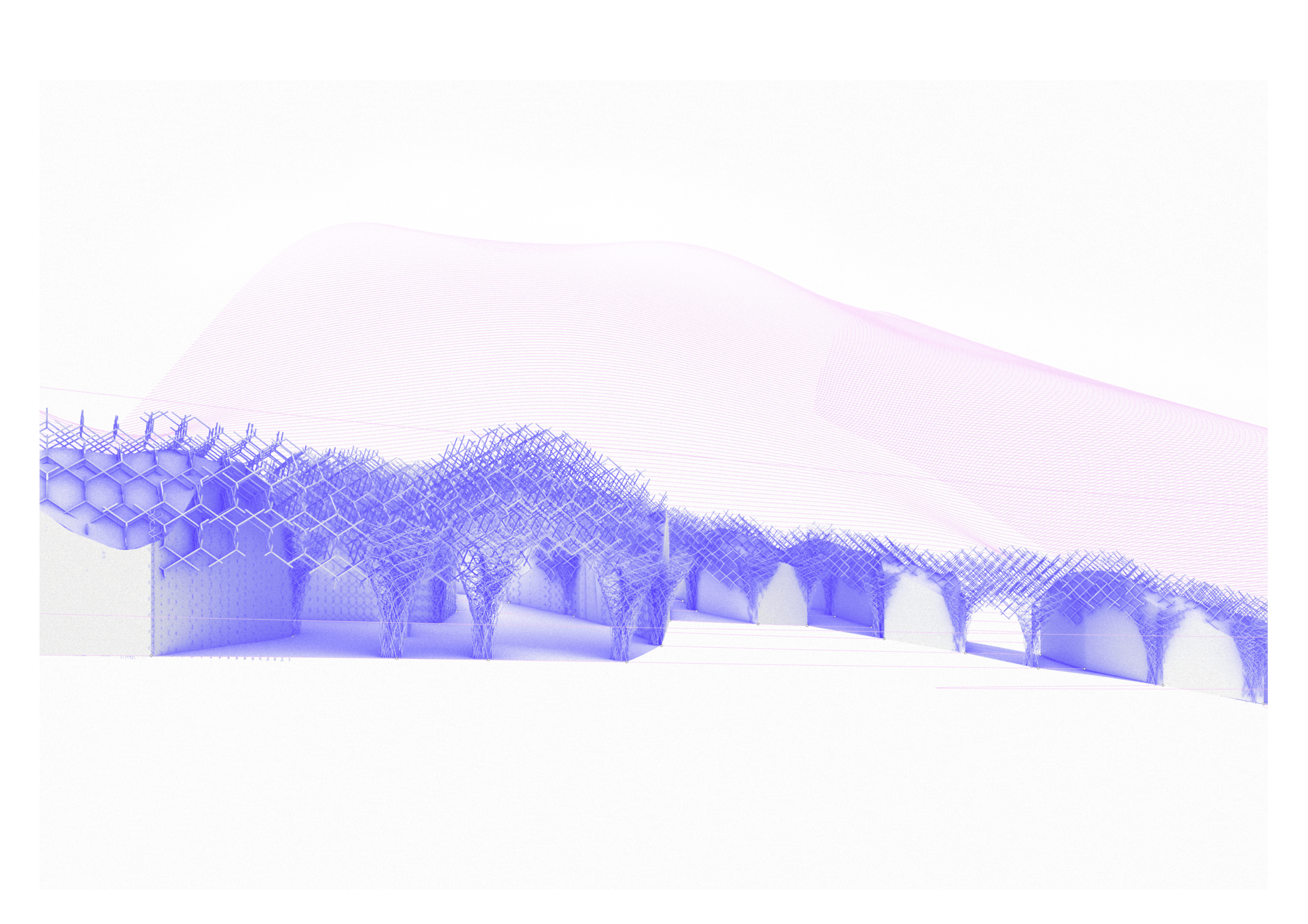
lattice structure
structural redundancy + ductility
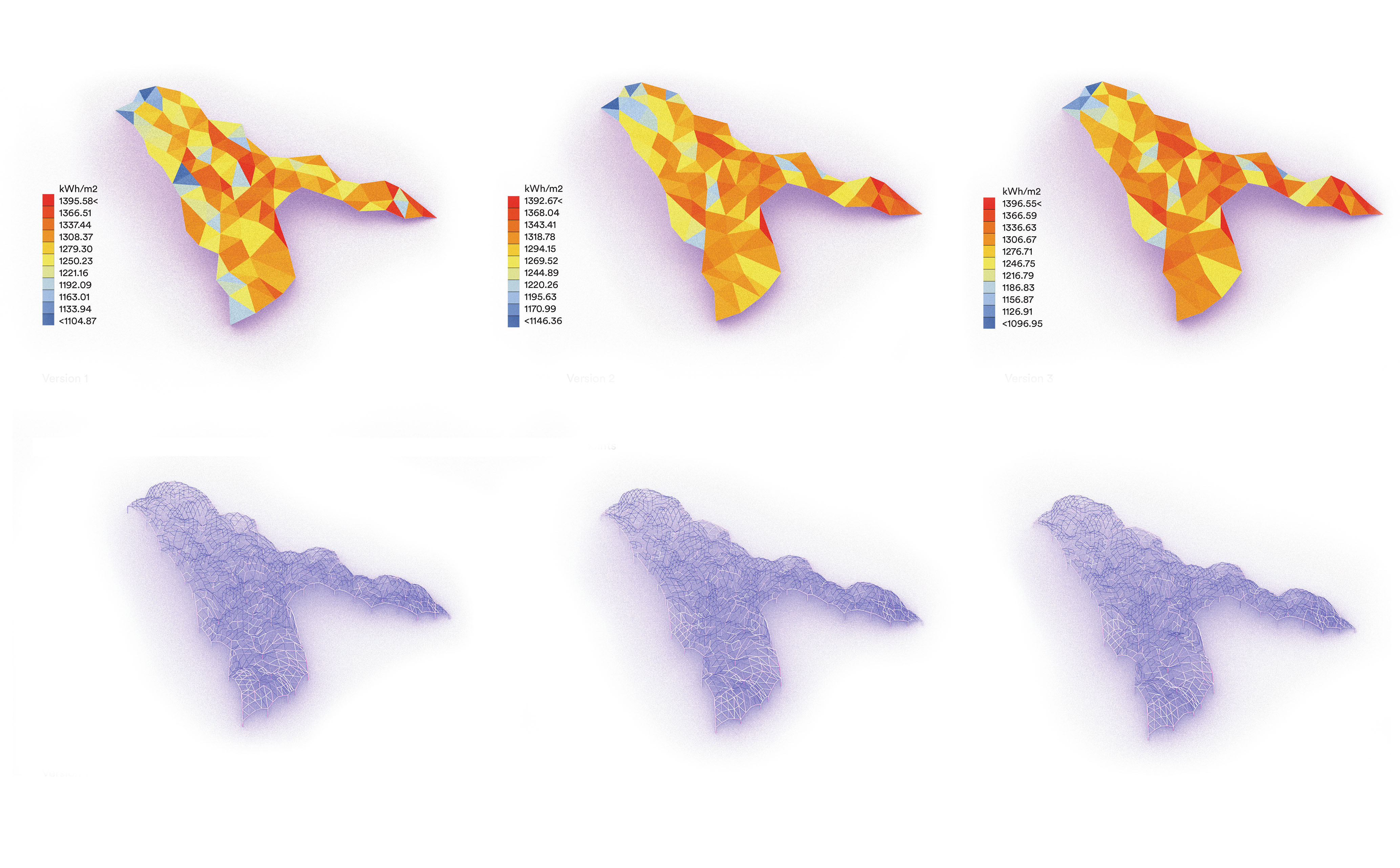
optimization of the roof for solar radiation and better structure performance


+39 327 633 6139 +383 44 135 472
erzadinarama@gmail.com
erzadinarama@gmail.com
Erzë
Dinarama unless otherwise specified

© 2